Thursday, 17 October 2013

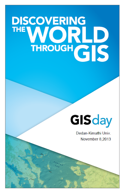
GIS Day-Dedan Kimathi University of Technology

Geospatial Information Science is one of the fastest growing field and being well appreciated by the industries to automate their tasks by using spatial data to solve problems,predicting the future of the organisations etc.GIS is being integrated in almost every other field due to its power in analysis and helping in concrete decision making for both people and organizations.

This event is the first to be held in DKUT and thus provides a good chance for students,people in corporate world and other interested parties to appreciate the use of GIS in the modern world and evaluate its capability to solve various issues affecting them.
The event will be held on November 8,2013 in the DKUT grounds and its expected to be a really great day of interactive sessions,presentations and talks for the attending persons.Every interested persons are welcome for the event on this day.For more details about the event visit HERE
Monday, 23 September 2013

Typhoon Usagi hits China

This is the worst typhoon ever encountered in China as it produced winds of  165 km/h to 180km/h in some areas.It swept the land leaving toppling trees as it blew the vehicles of the roads.The typhoon left many areas flooded causing the victims to drown in the waters.The storms left  3.5 million people affected,destroyed businesses leading to economic destabilization($526m losses).
 Satellite imagery provided information about the typhoon and various agencies were able to analyze the disaster.

NASA's analysis of the Typhoon Usagi-TRMM
satellite image taken by the Japan Meteorological Agency's MTSAT-2 satellite and provided by the National Oceanic and Atmospheric Administration (NOAA)

 For more info visit HERE


Tuesday, 17 September 2013

ASK Kabiruini Show 2013


The show took four days of great experience and interaction with other students, professionals and the industries. The institute of Geomatics, GIS and Remote Sensing (IGGReS) had a chance to appear in the campus’s main stand for the first time since the formation of the institute. The institute’s stand was represented by two students and one staff member. The main tasks were to explain more details about the IGGReS, courses offered in IGGReS, Showcase various projects conducted in the institute and offer assistance to any interested parties.
IGGReS Stand

Sam and Steve at the IGGReS stand

The two students(Sam and Steve) represented the Institute and also the GDev group(An innovation group formed by students from the IGGReS)Various ideas were showcased at the stand with the available materials such as the slide presentations and printouts of the satellite imagery and maps made as a result of various projects.
GIS is a field that is widely being appreciated by the world’s population as its able to assist in many ways in a cheaper way and maximize the outputs. The title for our projects was “Using GIS technologies in Agriculture” that rhymed to the show’s theme “Enhancing technology in Agriculture and industry for food security and national growth”. Some of the projects showcased were the mapping project and land suitability analysis both for the campus area(DKUT)Use of GIS technologies was appreciated by many who visited the stand with many wanting to learn about these technologies in details. The visitors of the stand were mainly the people from the corporate world, students and also the general public. The projects expounded more on the use of GIS, Remote Sensing and survey. Great appreciation of the GIS technologies was evident as the number of attending persons to the stand was huge per time.
The comments from the attending persons were encouraging and showed great appreciation.
Deputy President,William Ruto at the IGGReS stand
 Various dignitaries visited the stand and commended its good work. They included the Deputy President, Hon. William Ruto, who appreciated the work done and the projects showcased, The Nyeri county Governor,Hon.Nderitu Gachagua,who was very pleased by the projects from our institute and the Vice-Chancellor DKUT,who applauded the institute’s great work as he went around in the stand to get a glimpse of the projects that we had.
Hon.Nderitu Gachagua at the IGGReS stand

The ASK show was good for us having shown the attendees what GIS and Remote Sensing can accomplish in the current world. The event was successful and was a very good eye opener to the persons wanting to take a step further in the GIS and Remote Sensing field.

Thursday, 8 August 2013

End of Semester Departmental meeting


The day started well with preparations for the prayers meeting. The turn-up was great with 90% of the department members present for the meeting. This has been the best prayer meeting ever held in the department. Prayer meetings are always held at the beginning of the semester and at the end of the semester. Praise songs were many and the crowd was very active in participating to sing. Encouragement speeches were also allowed. Encouragements this time were many and this was an indication of how the students are encouraged by the event. Speeches were many with Sam Kuraru (Vice chairperson-DeKUTSO) gracing the event with encouragements, funny speeches and informative notes to the students. It has been a long journey since the beginning of the semester. This involved the many practicals undertaken and series of lectures in the course both for the second and third year students. The unity showcased by the students is commendable and encouraged as we journey together for the course.
                Rather than prayers, issues concerning the department were also addressed. There was a thanking session to recognize the great contribution by some student in the department. Photo shooting period was also available.
fans pose for a photo shoot with the trophy

fans posing for a photo shoot with the trophy

These included Mathew (Sports Captain),Faith(Young Generation Initiative),Sam Kibui (GEGIS & GIS blog),Thomas Kubai(Football coach),Hannah(Christian Union),Sam Kuraru(Vice-Chairperson DeKUTSO),  Ronald Kibet for the moral support just to mention a few.


Tuesday, 6 August 2013

University Football Tournament


          The University tournament took three months to complete. Each department in the campus was represented by their team in the football tournament. It all started small but kept on growing bigger and bigger with time. The GEGIS department was represented too in the tournament. The players worked hard to outdo the competitors with great support of the department members. Every time our group had a match with another department, the field was filled with great numbers of fans cheering up their squad. Our squad was well composed and ready for the big challenge. This was followed with a series of games and our squad emerging victorious. The tournament was structured in terms of group stages. GEGIS squad was able to beat their rivals in the group stages and proceeded on to the next level.

Fans posing for photos after a match

At quarter finals, the games were a bit tight but we made it through. As its well-known, as the completion ladder rises, competitions get heated up and extra work has to be done in order to succeed. After some time of practice, the squad reached the semifinals. Competition was tight. The teams played well and it all ended into a draw. The only way to separate the tie was through penalties.
Our squad lost at penalty level with an outcome of (3-4) in favor of the opponent. Our squad’s target of winning the big cup was short-lived. As usual the recognized tournament teams are mostly the teams in the first, second and third positions.

Saturday, 3 August 2013

GEGIS and GIS Talk


      Two weeks after visiting one of the firms that deals in GIS and its products (Ramani Geo systems), here is another firm that deals more with GIS, software and equipment related to the field. The GIS and GEGIS students had a chance to interact with a team from Oakar services and share more about the well about of the field in the industry. GIS being the key area of specialization for the Oakar Services was extensively explored with different technology being showcased to the students. The students had a chance to have a touch of what is expected of them after completing their undergraduate studies.
      This talk comes as a morale builder to the students to enable them develop firm interests in the field and develop their great ideas that would help solve issues in the world. GIS, a vast field has lot of smaller sections to be studies and they relate to each other well at the end.

Saturday, 27 July 2013

GEGIS and GIS Visit(Third year)

Visiting the industries in the field of Geomatics and GIS is one of the facilitating factors for students undertaking the course in any of the universities.Students get to understand more what they learn theoretically and may be practically.Ramani Geosystems was the chosen firm where the students had great experience of what is done outside the campus.The firm offers professional land surveying, aerial photography, aerial LiDAR and GIS and mapping services which are the key areas of study for the Third Year students.
A lot was demonstrated to the students including flight planning,image registration,image enhancement,digitization,triangulation and 3D modelling just to mention a few.Having covered most of these areas in the previous lectures it was a great day of experiencing the tangible part of the course.Geomatic and GIS are two very wide fields of study.They are composed of very many divisions and are mostly related in application.

Tuesday, 9 July 2013

Shisha


Shisha is among the latest form of youth and
Middle-age group form of clubs-best-narcotics
having gained popularity in the recent past
It is mainly enjoyed in groups from a shared pipe and
Most people have come up with theories that shisha is much better
than cigar. But for me i wouldn’t trade any of the two for the other, they are all equally harmful
Shisha is in no way
beneficial or less harmful to one's health
compared to cigarettes.
 Here's just a few reasons why:
1. Myth: The water is said to act as a filter
and thus the smoke we inhale is supposedly
"clean". Well, that's not true. In fact water
moisture just makes the smoke less irritating
and gives us the impression that the smoke is
cleaner and makes it less irritating.

Monday, 8 July 2013

Coupling in Campus


 A relationship happen between two parties of which mostly its
between man and women. This happens
because everyone needs someone to love
and fall in love with. This feeling is complicated
to be explained by just using words.
The funniest bit of it; it happens naturally and cannot be
forced. However, today,coupling has become
an issue because it is always been related
to social problem.
Actually, coupling is
something that we might not be blamed of
because it is very subjective and we cannot
define it as a problem. It’s a
culture among students in higher education
institutions either government or private
institutions. 

Tuesday, 4 June 2013

Landsat 8 Launch


       Here is advancement in the GIS world. With the Landsat Mission that has been available for about four decades, Scientists and researchers in the GIS field have benefited from the services available on the Landsat system. This has helped us understand our home “Earth” better by monitoring the changes both in natural and human activities. This has been possible by assisting the people to view the world beyond what the human sight can perceive. The Landsat 8 is much advanced than its predecessors having high precision and modern sensors. Using the Landsat 7 and Landsat 8, more scientific tasks will be achieved as the two can now provide the required data wherever needed. The Landsat mission will document various phenomena such as volcanic eruptions and forest fires.

Thursday, 30 May 2013

Control points Marking,Nyeri County


Dedan Kimathi University of Technology was selected as an ample location to lay a pillar marking the control points by the Survey Of Kenya in a project set to mark new control points in the whole country in the year 2013.The pillar erected at the DKUT fields is of order one and is inter-visible from the pillar of order zero located at the top of Nyeri hill. 


This is to provide a better platform for surveyors who might be interested in carrying out survey tasks around Nyeri as there is a number of control points now available and the surveyors can use the one that suite them better . The pillar was erected on Tuesday 28th  May,2013.

Tuesday, 21 May 2013

First semester departmental prayers


         Today 21st May 2013 marked the day for the departmental prayers for the academic year 2013/2014.This is an activity conducted at the beginning of every semester within the Institute of Geomatics,GIS and Remote Sensing.Its a dedication of our life,friends and the department to the Almighty God.The event took place in the best way with the best students turnover ever recorded in this department.The beginning of every semester is very crucial and one can determine how the semester prevails just by your starting plan.Present in the prayers meeting were the representatives from the department,the director and the department students.This serves to bring the students together as one community and also help bridge the relationship between the students and the seniors in the department.

Monday, 25 March 2013

Attachment period photos

 <<During vertical control practicals
                                    a group participant>>>
 <<<< levelling the theodolite
                                         Group 1 at work>>>
  <<<Group 6   
                        Resting after practicals>>>
     <<<<Story time after work            
                                     holding a staff vertical>>>>
     <<<After work            
                                             survey equipments>>>
      <<<Using ERDAS--Remote Sensing          
                                         In a GIS lab>>>

INTERNAL ATTACHMENT COMPLETION

        The attachment commenced well on 21st January 2013 and lasted 8 weeks.All the required sectors of the attachment have been covered and reports submitted to the supervisors(department).The faces to be covered included the GIS,Remote Sensing and survey(vertical control,horizontal control and Cadastral survey).As we come to the end of the internal attachment,we happy to say that the attachment has been a success both to the students and to the department since all the activities have been concluded.
        At the end of every attachment,a comprehensive report indicating all the activities covered during the attachment period is compiled and handed in to the supervisor for marking.The students expresses their gratitude to the department for the continued support/assistance during this period and making the session all a success.Having done all this the students are free to leave for their destinations(homes/domicile).
        25th March,2013 marks the end of the internal attachment in Dedan Kimathi University of Technology(DKUT).Wish all the participants of this session a happy holiday,a fantastic Good Friday and Easter holiday.see you all in May 2013.